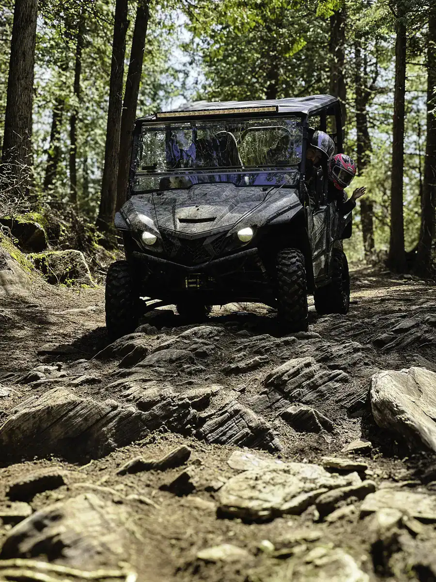
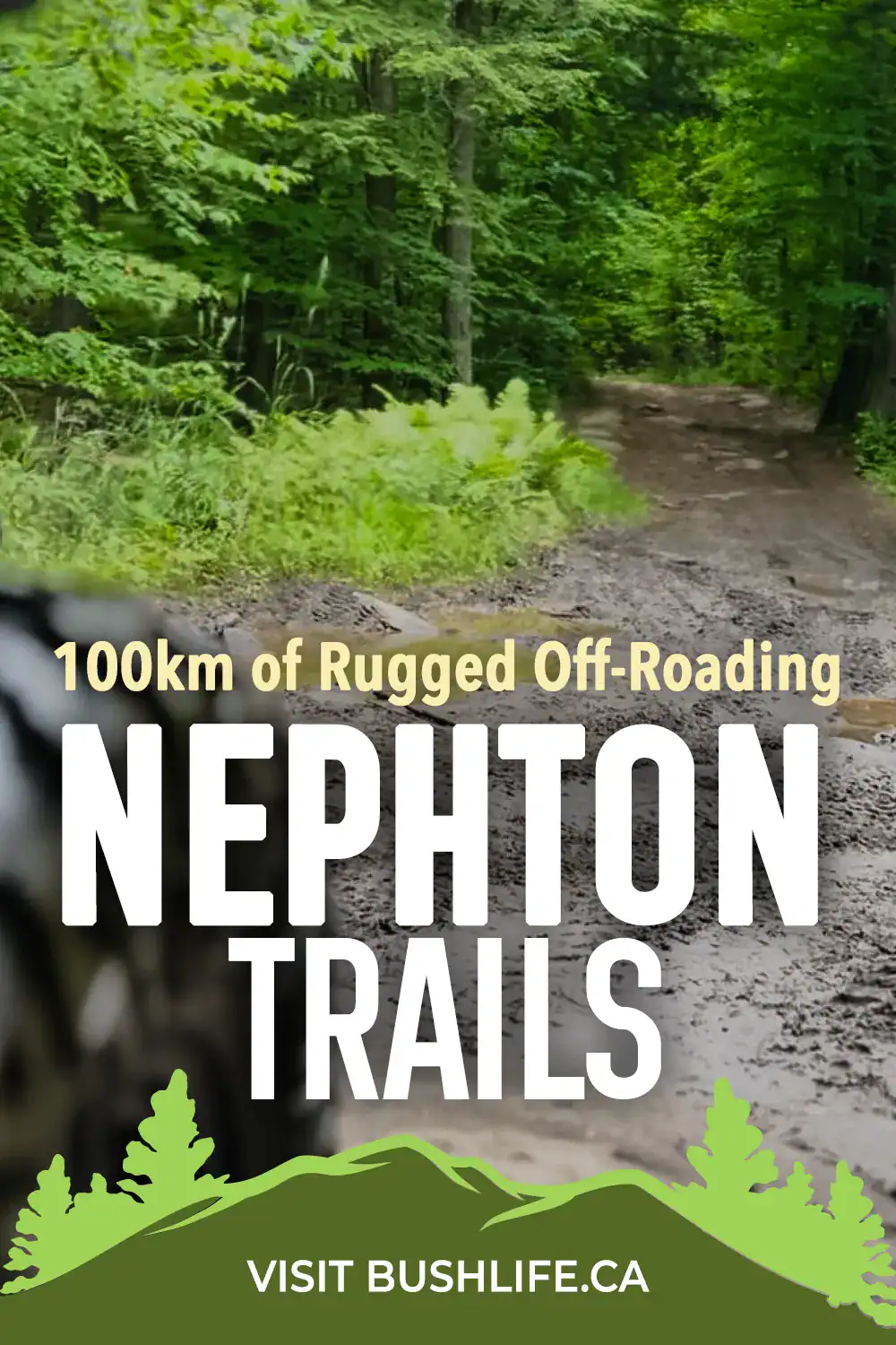
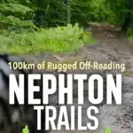
Nephton Trails in Ontario feature 100 km of rugged Canadian Shield backcountry, with steep climbs, Crown land camping, and epic lookouts. These ATV trails in Peterborough County are a challenging off-road adventure you won’t find in most trail directories!
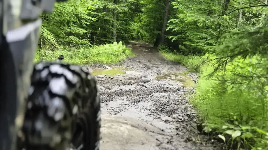
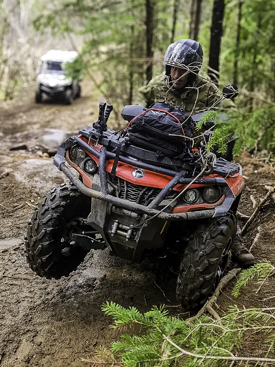
Worried about the difficulty of the Nephton Trails? Don’t be! There is enough trail for newbies to enjoy and plenty of rugged terrain for the pro rider to feel challenged. I remember my first ‘white-knuckle’ ride on these trails – I was certain my heart would pound right out of my chest as I navigated a steep descent. But by the end of the day, I was laughing at my own nerves. So, whether you’re riding an ATV, dirt bike, SxS, or 4X4, this Peterborough trail will definitely get your adrenaline pumping!
Spread the Love
Disclosure: Posts may contain affiliate links. Purchases made through our links result in a small commission to us at no charge to you. We only recommend products that meet our brand standards based on testing and first hand use by our authors.
Where Are the Nephton Trails?
Nephton Mine ATV trails are nestled in the heart of the Canadian Shield, which runs through the forests of Peterborough County, Ontario. To get there, head down County Road 6 toward the Covia (Unimin) Mine. Just before the mine entrance, you’ll spot a wide parking field on the left, perfect for unloading your rig and staging your ride.
Nephton trailhead coordinates for riders: 44.613890, -78.014435
Do You Need a Trail Pass for Nephton Trails?
Yes, you do need an OFATV trail pass in Ontario, which you can purchase from the Ontario Federation of All-Terrain Vehicle Clubs website.
How Much Are Ontario ATV Trail Permits?
An OFATV annual permit costs $150 tax in. Know that the trail pass does not give you access to all of Ontario’s ATV trails. The permit is for one trail system. In other words, it’s a local club pass – in this case, it would be for the Coe Hill Riders ATV Club.
The OFATV is working on allowing riders to access Ontario’s entire trail network. For those who prefer accessing different trail networks, consider buying a 3-day permit for $55, tax included, or a 1-day permit for $25. You also have family pass options.
Trail Overview: Routes, Distances & Terrain
The Nephton Trail System is a crown game preserve. In speaking with MNR, we are receiving conflicting replies on whether we can transport a firearm if we are just passing through the Peterborough Crown Game Preserve with no stops. Since there’s no clear answer, it’s safe to leave firearms at home; it’s not worth the risk of losing your license. You can check with the Ontario Crown Game Preserves map for boundary info.
And, yes, this trail network is patrolled by the OPP, more so during the snowmobile season.
OFSC E107 Snowmobile Trail Connection
In this post, I reference the E107 snowmobile trail Ontario. While technically a snowmobile trail, some offshoots connect to the Nephton ATV system. The OFSC E107 trail connects with the E106 and E snowmobile trails. This loop is known as the Hav-a-Ball Tour and is approximately 253.3 km long.
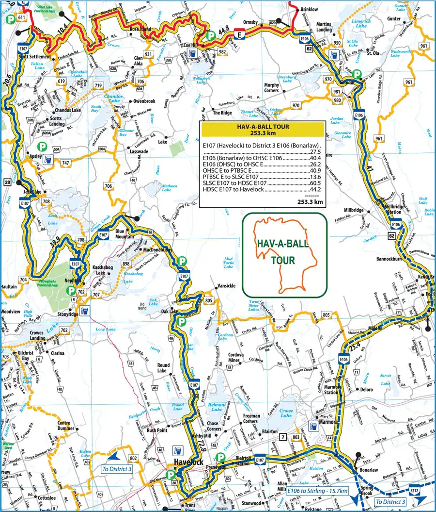
Hav-a-Ball Snowmobile Tour Loop
From Nephton Trail parking, head north to Tatten Lake Rd past Apsley, east to Brinklow via Coe Hill, south to Bonarlaw, west to Havelock, and back to Nephton.
Use lake crossing offshoots to shorten the loop (check map).
Note
Check with the Ontario Federation of Snowmobile Clubs’ trail map for up-to-date trail openings and closures. For various reasons, such as leaving behind garbage, destroying property, riding off the trail, etc, many landowners are refusing access to their property.
FURTHER READING:
Is Snowmobiling in Trouble? Includes how this trail has changed over time.
Nephton ATV Trails
Getting back to off-roading! The snowmobile trail network is massive; unfortunately, the same cannot be said for the off-roading trail system. Access to private property and lakes will close for the season, while several ATV offshoots will open, but are not easy to find.
For the sake of this post, we’ll focus on the popular trails that have the most to offer. The Nephton ATV Trails in Peterborough County range from intermediate to difficult. Most areas aren’t excessively challenging; however, you will encounter a short, steep rocky descent to Ties Lake and a steep rocky incline to Little Jack’s Waterfall, which will put your off-roading skills to the test. If you’re a beginner, I suggest you read my ATV climbing post for some tips.
👉 Would you tackle a rocky descent like this solo, or do you always ride with a buddy?
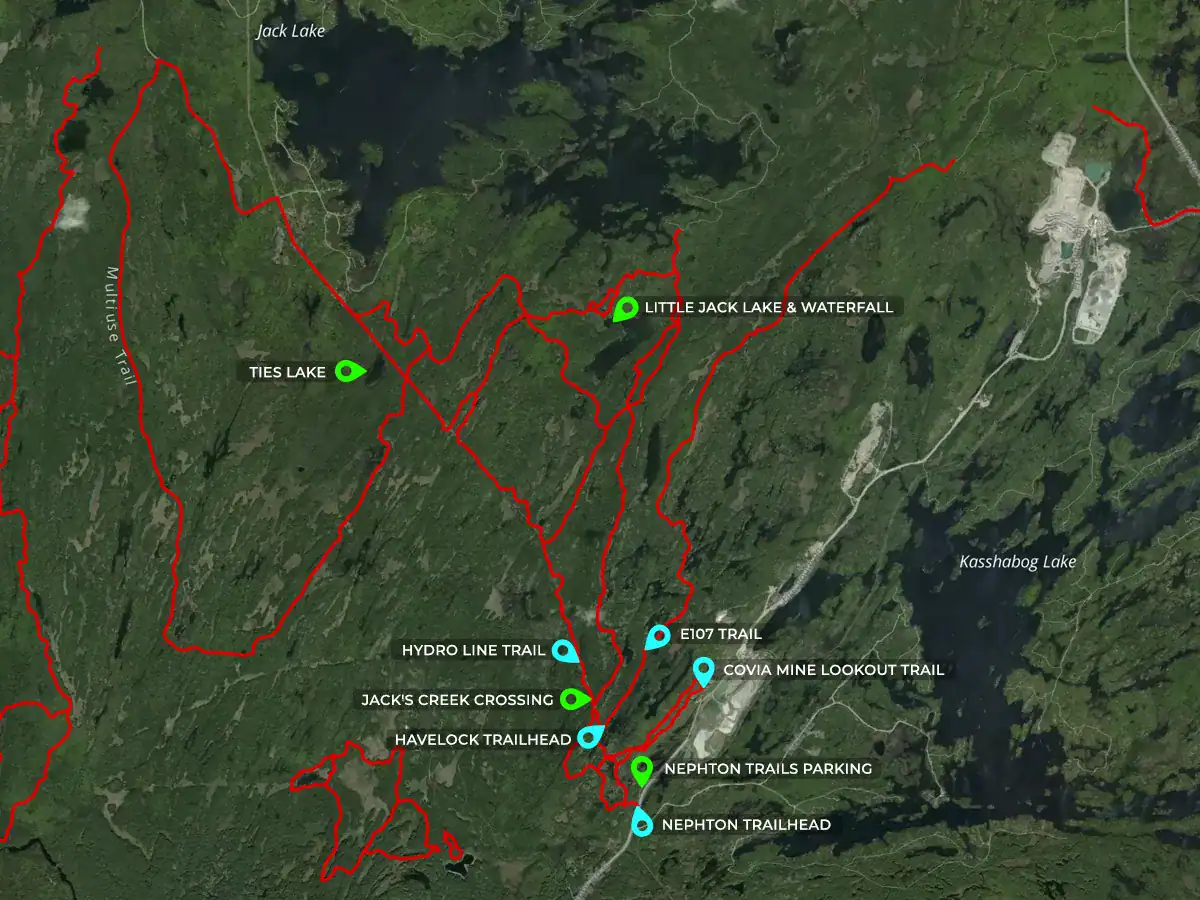
As mentioned earlier, the ATV trail starts at the Nephton parking lot, off County Road 6. The ATV maps mark it as CH200, and the snowmobiliers as OFSC E107.
Note on Closures
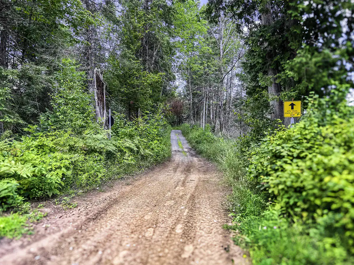
The OFSC trails are maintained for snowmobile use. Off-roading vehicles are prohibited during snowmobiling season, which usually runs from December 1st to snowmelt (March/April). The Peterborough area was hit hard by a nasty spring storm, which downed many trees; be prepared for some sections of the trail to be closed or rerouted. Pack a small chainsaw – you may need it!
Nephton Main ATV Trail, Ontario (Nephton Parking Lot to Circle Fork)
- Terrain: Nice, wide trail. The beginning of the trail is graveled with easy inclines, which transition to intermediate Ontario ATV trails.
- Covia Mine Lookout Point Location: 44.618064, -78.016682 – about 1.3 km in, on the right is the Covia (Unimin) Mine trailhead.
- Destinations: At the Circle Fork, head straight through to the Havelock Trail (E107 heading south) or turn left to the Hydro Line / E107 Snowmobile Trail heading north
- The Circle Fork is a perfect spot for a breather – not much to see in terms of views
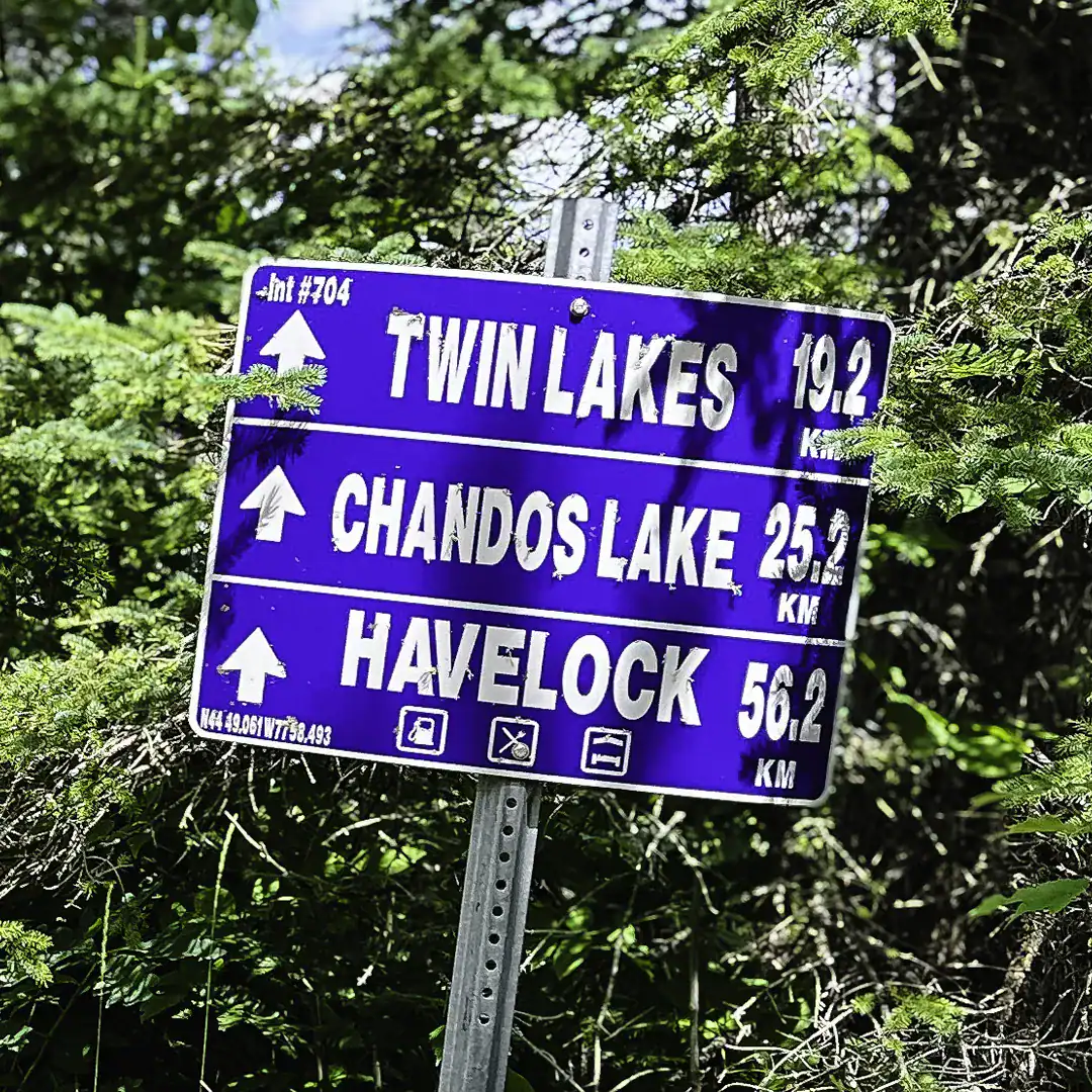
Fork 1: ATV Trail to Havelock, Ontario (E107 South)
- Havelock Trailhead Location: 44.622116, -78.018742, approximately 56 km to the Town of Havelock.
- Terrain: Easier terrain, great for beginner riders.
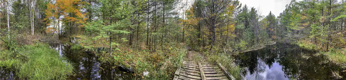
- Destinations: During the snowmobiling season, the trail splits – for Twin Lakes and Havelock, continue on E107, or veer left (route 706) to Chandos Lake. At the split is the Jack Creek bridge – peaceful spot for a lunch or breather.
- Obstacles: Several clicks in on the Havelock ATV trail, the trail is closed for the ATVing season. The bridge is in bad shape, you’ll need to make a water crossing to by pass it.
Fork 2: Hydro Line ATV Trail Ontario (CH210 / E107)
Locals know this route as the Hydro Line, but on trail maps you’ll see it labeled as CH210, and on the ground it overlaps with the E107 snowmobile trail. No matter what you call it, this section is one of the most challenging ATV trails in Ontario, with rocky climbs, creek crossings, and remote terrain that demands skill and preparation.
Trail Details:
- Trailhead Location: 44.624048, -78.020288 – about 1.5 km from the Nephton parking lot.
- Getting Started: At the split, veer left for the Hydro Line (CH210, easily missed), or make a slight right to stay on the E107 (CH200).
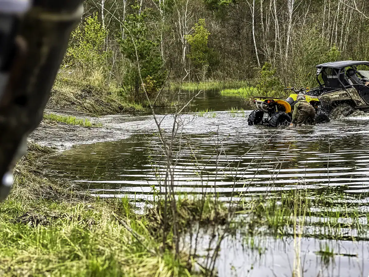
- Terrain: Graveled beginning, which cuts back on the difficulty. Technical riding with steep off-camber slopes (aka steep inclines), rock gardens (not that kind of garden ;)!!!) and deep descents). Expect water crossings, especially in the spring.
- Obstacles: The Hydro Line bridge was swept away in a storm, so riders must cross Jack’s Creek directly. In early spring, the water can be high – a real hydrolock risk if you’re not careful.
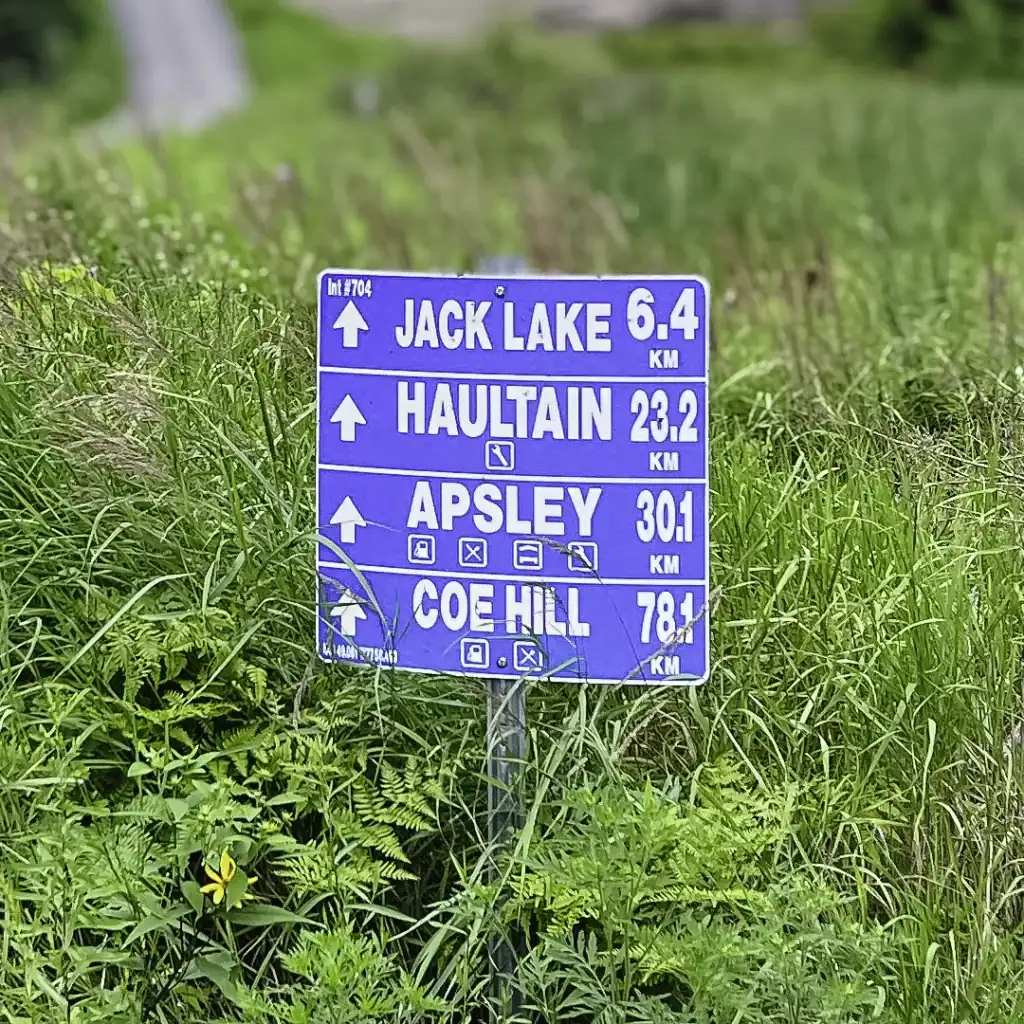
- Destinations: The Hydro Line connects to Ties Lake (about 7 km), Haultain, and Apsley. The E107/CH200 branch leads to Little Jack Lake waterfall and Lookout (about 10 km), and eventually reconnects with the Hydro Line.
Note on Closures
Some sections of the Hydro Line have been permanently closed. Always check updated trail map apps before heading out.
Off-Road Mapping Pro Tip
With so many forks and offshoots on the Ontario off-road trails, I suggest carrying a laminated trail map and a GPS unit, just in case batteries die or satellite connections falter. Having a map on hand strengthens your self-reliance on the trails. We use the QuadOn GPS app Ontario ATV trails to plan routes and a Garmin handheld to help track and mark favourite hangout zones. The Lantern map shows you more offshoots and is great for planning a camping adventure.
Crown Land Camping Near Nephton Trails Ontario
One of the biggest perks of exploring the Nephton ATV Trails is the opportunity to camp for free on Ontario Crown land. If you’re looking to combine rugged off-roading with an overnight stay, this area offers plenty of options – do respect the rules and boundaries!
Camping Guidelines:
- Camping is allowed in many areas off-trail on Crown land.
- Parts of this area fall within a Crown game preserve (including sections around Jack’s Lake). Always double-check the Ontario Crown Game Preserve map before planning an overnight stay.
- By law, you can camp on Crown land for up to 21 days per site per calendar year, after which you must move at least 100 meters to a new location.
- Check local fire regulations before starting any campfires: rules can vary by township and change frequently.
- Do not camp within Petroglyphs Provincial Park – use the Lantern App or the Ontario Crown Land Atlas to confirm boundaries before setting up.
Best Camping Zones Along Nephton Trails:
- Little Jack Lake: Backcountry feel with nearby waterfall – one of the most popular Crown land camping spots in the area.
- Ties Lake: Secluded forest setting, great for groups or extended stays.
- Trail Head: Near the Nephton parking lot for quick access and staging.
- Creek / River Crossings: Natural pull-offs where you can combine camping with a swim (use caution at crossings when swimming).
App Pro Tip
Use the official Ontario Crown Land Atlas or the Lantern App to double-check your camping location. Boundaries can be tricky, and a few minutes of research will help you avoid fines or conflicts with protected lands.
Must-See Viewpoints on the Nephton Trails
The Nephton trails are quite remarkable! Our favourite route is the rugged Hydro Line leading to Ties Lake and veering off to the Little Jack Lake waterfall – especially during autumn when it’s warm and the leaves are changing colours.
The start of spring is also a favourite of ours – you will not see me in there during the summer!!! The bugs are horrendous, and some of the trail legs are deathly hot! Early spring has little to no bugs, deep mud, and high water level crossings, which allows for a more thrilling ride. There is something euphoric about ploughing through mud with your rig and arriving home dirty! Although rescuing a stuck vehicle in the mud is not so fun.
Below is a list of must-see viewpoints along the Nephton trails in Peterborough County.
1. Covia Mine Lookout Point – Epic Ontario Backcountry Views
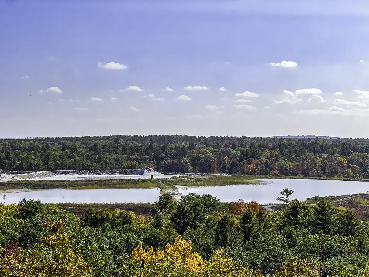
- Covia Mine lookout in Ontario has the highest elevation point on the trail
- Enjoy sweeping Nephton ATV trail viewpoints of Kasshabog Lake, Stoney Lake, and the Covia Mine
- Epic spot for sunrise/sunsets
- Superb climb for mountain bikers, ATV riders, and dirt bikers
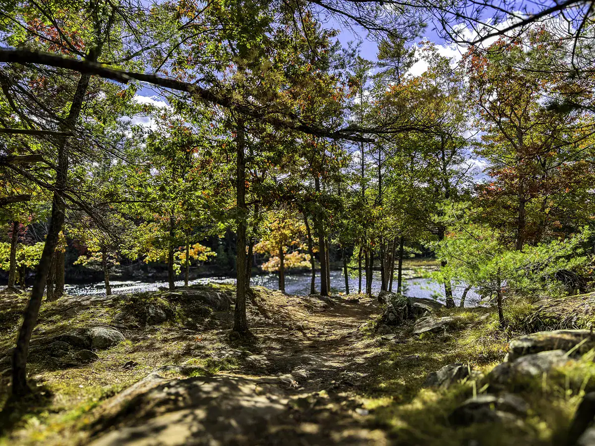
2. Little Jack Lake & Waterfall
- Lush forest surroundings
- Cascading waterfall overlook
- Great for photos, backcountry camping, or for a little solitude
- Little Jack Lake waterfall camping is the most popular backcountry camping zones in Ontario. Between the roar of water, towering pines, and the golden light in fall, it’s everything you expect and want from the pure Canadian wilderness.
Watch drone footage of Ontario’s Jack Lake Waterfall (YouTube)
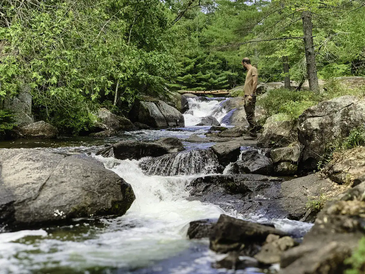
3. Jack’s Creek ATV Crossing, Ontario
- Jack’s Creek ATV crossing is a natural pull-off along the Hydro Line
- Ideal for mid-ride breaks or a quick swim (careful – it’s a vehicle crossing!)
4. Jack’s Creek Bridge Off-Road Trail, Ontario
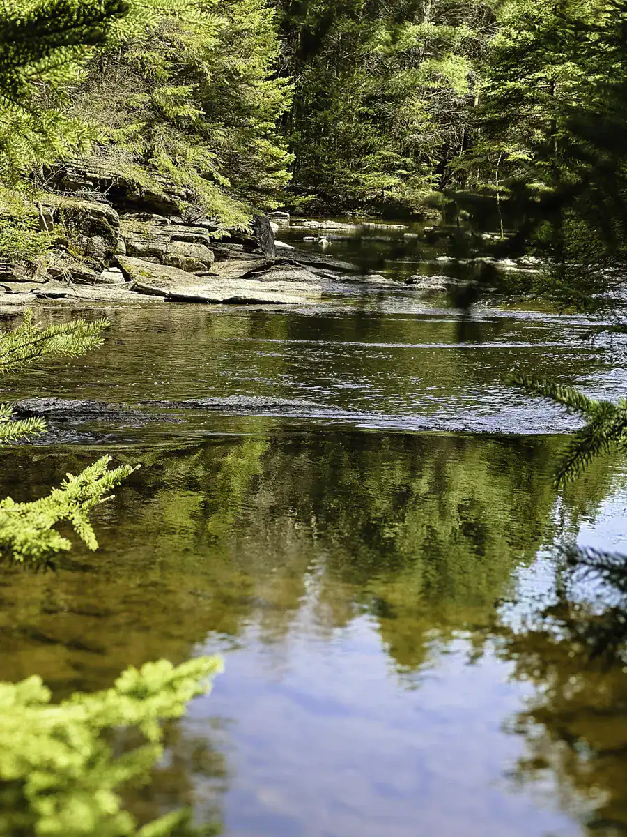
- Surrounded by lush forest
- Jack Creek is wide with a tiny rapid (if water levels are high)
- Perfect for resting, swimming, or wilderness camping
Best Time to Ride the Nephton Trails
Timing your ride can make all the difference when exploring the Nephton ATV trails in Ontario. While the trails are open year-round, conditions vary with the seasons, and knowing what to expect will help you plan a safer and more enjoyable adventure.
Spring (March – May)
- Trails are muddy and water levels are high – perfect for thrill-seekers who enjoy challenging terrain.
- Early spring is ideal for avoiding mosquitoes and black flies, which become more aggressive later in the season.
- Water crossings, like Jack’s Creek, can be difficult due to snowmelt. Check trail conditions and wear waterproof gear.
Summer (June – August)
- Warm weather makes for comfortable riding, but bugs can be intense.
- Trails may be drier, which is easier for beginners, but heat and long rides can be exhausting.
- Avoid late-evening rides – if a vehicle gets stuck, recovery can be physically demanding and take a long time.
Fall (September – November)
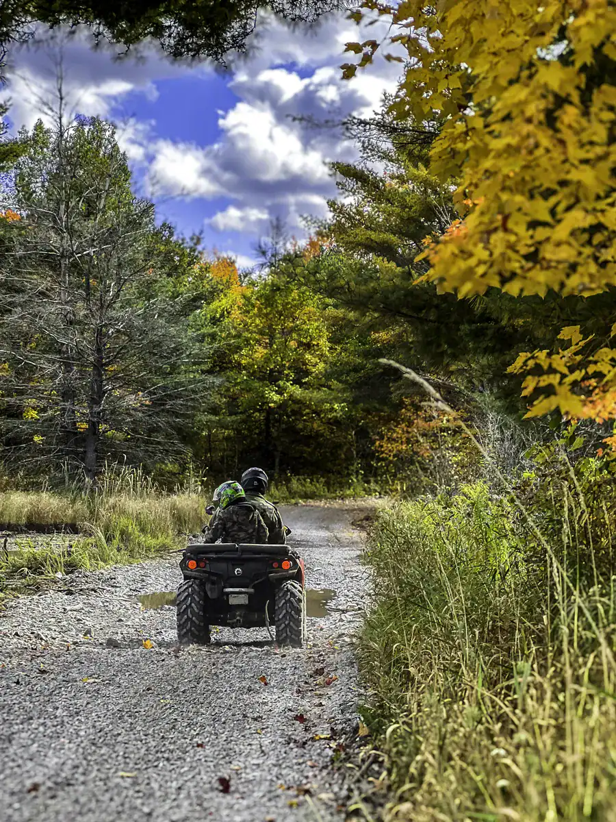
- A favourite season for many riders – crisp air, fewer bugs, and stunning fall foliage along the trails.
- Cooler temperatures make steep climbs and technical sections more manageable.
- Great for backcountry camping near Little Jack Lake or Ties Lake.
See our Nephton ATV trail ride video: Fall Colours Ride at Nephton (YouTube Shorts)
Winter (December – March/April)
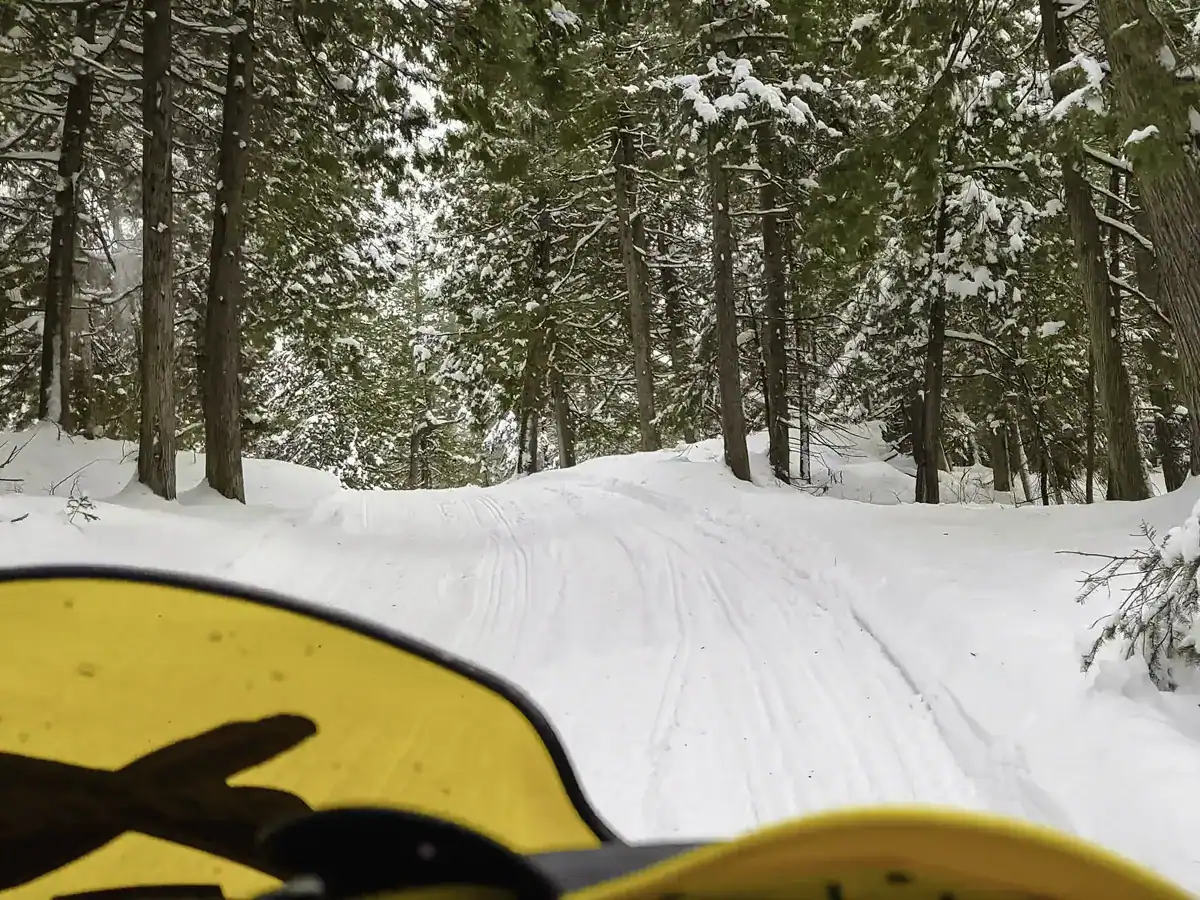
- ATV trails are closed to off-road vehicles during snowmobiling season, which runs from December 1 until snowmelt.
- The area can get heavy snow coverage, making it ideal for snowmobile enthusiasts.
- If you plan to explore the area during this time, check the E107 / E106 snowmobile trail network and local club guidelines before heading out.
Pro Tip on Trail Conditions
Regardless of the season, always check trail conditions on apps like QuadOn or Lantern, and bring essential recovery gear. Early spring and fall are generally considered the best balance of trail accessibility, scenery, and rideability for most riders.
Recommended Gear for Riding Nephton Trails
I cannot stress this enough – pack ATV recovery gear for Ontario backcountry trails, or for any trail for that matter, including spare parts for your vehicle and snacks! The Nephton trail network is pretty quiet during the week. If, or I should say, when you break down, it takes time for help to arrive.
Learn to be self-sufficient and bring someone with you – preferably someone with a vehicle! A second person with an extra ATV can help retrieve your ATV from sticky situations or drive out for help. If you’re looking for company, there are plenty of ATVers on Facebook that organize group outings.
For those who love remote areas, consider using Rogers satellite service for emergency use.
Gear Guide
Here is a short list of what to pack for ATV trails in Ontario. A complete gear list would depend on your rig and the intent of your stay.
- Recovery strap + winch system
- Mud tires + air compressor (spare tire & belt)
- Waterproof hiking boots or tall hunting boots
- Chest waders (Finntrail is pretty good!) or rain pants (for those got stuck moments)
- Cooking gear for bush meals
- Lightweight tent + sleeping bag
- First aid kit
- Mosquito protection (a must in the woods)
- Chainsaw (min. 16 inch) or at a minimum folding handsaw
- GPS unit or maps
- Snacks, water (water filtration bottle)
Before heading into Nephton, make sure your recovery gear is dialled in. This isn’t the place to rely on luck if you bottom out on a climb, get stuck in a mud bog, or get wedged in a rock cliff.
Recovery Pro Tip
Why make recovery harder than it needs to be? Pull a few feet of winch cable out and clip it to your driver’s side door post. This way, when you get stuck in the mud (and you will), you have quick and easy access.
Prepared off-roaders carry a small chainsaw or saw to help clear obstacles instead of going around them, keeping the route usable for everyone. It’s a small gesture that makes a big difference. When you come across an obstacle, do you part and help clear it. You never know, one day it might be you that needs rescuing – and keeping trails clear helps the whole community.
- Why You Need a Grappling Hook for Self-Rescue – Essential for steep or narrow recoveries
- How to Winch Yourself Out Safely – Don’t destroy your rig or tree in the process
- ATV Climbing Tips: Stay Upright on Steep Trails – Especially helpful for the Hydro Line incline section
- Prepping Your ATV for Trail Season – Check this before you head out in spring or fall
Quick Guide & Final Thoughts: Nephton Trails Ontario
The Nephton Trails in Peterborough County, Ontario, are perfect for all riders looking for a thrill – the sights and sounds never get tiring! Here’s a handy at-a-glance guide to plan your ride:
Quick Guide
- Location: Nephton Trails, Peterborough County, Ontario – a top destination for Ontario ATV trails
- Trail Difficulty: Intermediate to advanced; the Hydro Line ATV trail is the most technical section
- Best Seasons: Early spring (muddy, adventurous) and fall (cool, scenic foliage) are ideal for riding
- Camping: Crown land camping Ontario near Little Jack Lake, Ties Lake, and trailhead areas (maximum 21 days per site)
- Permits: Annual or short-term OFATV trail pass Ontario required
- Must-See Viewpoints: Covia Mine Lookout, Little Jack Lake waterfall, Jack’s Lake Bridge
- Gear Essentials: Recovery strap/winch, spare parts, saw, GPS/maps, waterproof boots, snacks, first aid
Ride, Explore, Repeat!
Pack your gear, grab a friend who likes to get dirty, and don’t be afraid to hit the trails! From the technical climbs of the Hydro Line to peaceful, serene spots for Crown land camping, every ride is a chance for discovery – and maybe a little mud. Conquer steep inclines, splash through creek crossings, or soak in the golden light at Little Jack Lake – the Nephton Trails are all about the thrill of the ride.
👉 Found a hidden route or a favourite viewpoint we didn’t mention? Share your adventures in the comments! The off-roading community thrives on shared tips, epic stories, and a little bragging – and who knows, your next ride might inspire someone else to tackle the trails too!
Bookmark this post on Pinterest for future reference!


I’m never against a little adventure, and this one looks fun and beautiful, with a nice little camping spot and gorgeous scenery.
Thanks for sharing!
I’ve never done an offroad adventure like this, but that’s a great introduction to the Nephton trails!
Would definitely recommend it! Some spots are not for the faint of heart, but if you’re experienced, you’ll be fine. Would love to hear how you made out if you do decide to take the Nephton trail on.
Glad to hear that you’re up for some adventure – ATVing is definitely something that should be on your bucket list! It’s rewarding to find little nooks that would take hours or days to find by foot and the thrill of riding is just a blast. Let me know how your first ride goes. 🙂
Good adventurous place well shared with beautiful photos 😊
Thank you for your lovely comment – much appreciated! The Nephton trail is a beautiful spot for anybody that loves exploring the outdoors.